Geographic Information Systems and SBCC Research on Health COMpass
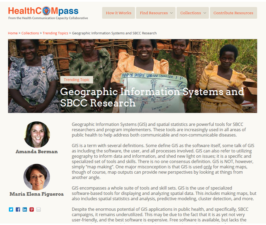
 Geographic Information Systems (GIS), a form of research that is relatively new to the Social and Behavior Change Communication (SBCC) field. It can add tremendous insight and new perspectives to SBCC research.
Consider, most recently, the Ebola epidemic in Liberia – the Health Communication Capacity Collaborative (HC3) is part of this response. Radio spots will air as one component of the campaign. However, it may be useful BEFORE airing the radio spots to know several key factors… Is radio coverage universal? Will all counties and districts hear the broadcasts? Or, how many people have access to or own radios? These issues will help to predict the reach of messages. Furthermore however, content may vary geographically. In areas hardest hit, people may be more used to seeing health workers, they also may have certain beliefs and attitudes about healthcare workers. Messages may need to be tailored to fit distinct audiences.
No two individuals are the same, let alone towns, districts, or counties. The best we can try to do is hone in on the finest level of detail possible and craft messages that are not only going to be heard by individuals, but will be content-appropriate.
Formative research – in the form of two-way SMS surveys allowing for remote and electronic data capture – has illuminated different attitudes and levels of knowledge by county. If, for example, a greater percentage of the population in one county is knowledgeable about the means of transmission, and has decent radio coverage and access, communication may be more appropriately crafted. A radio campaign addressing crucial information, other than the modes of transmission, may be best. On the other hand, if a lower percentage of the population of another county reported lower knowledge about how Ebola is spread, and this county has poorer radio coverage and access, perhaps billboards and community meetings would work more effectively to communicate modes of transmission to these populations.
Take a look at the map section of the Ebola Communication Network’s website http://ebolacommunicationnetwork.org/maps/. More maps are in the works, focusing on overlaying existing case and population data with communication access, as well as results from the SMS survey.
This is only one example. So much can be done with GIS, from process monitoring to predictive modeling; from informing program design and implementation to evaluation and redesign and implementation. Use of technical GIS software may not always be the most user-friendly, but there is a push for greater use in public health, and GIS-related materials are becoming more and more available. To provide more insight, examples, and tools for GIS, the Health COMpass team created a new Trending Topic on the subject of GIS and Social and Behavior Change Communication.
GIS provides an amazing perspective – a geospatial perspective. In tandem with other research methods, this can be tremendously useful.


Leave a Reply
Want to join the discussion?Feel free to contribute!